swoon / one-photo / East Toronto 2023:
man. what a photo.
There's a lot going on.
There's a lot going on.
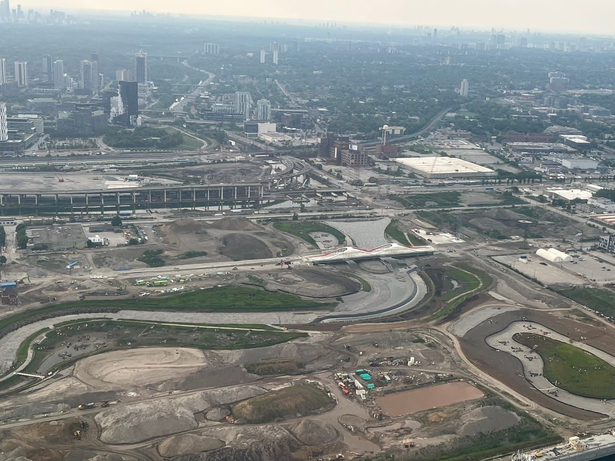
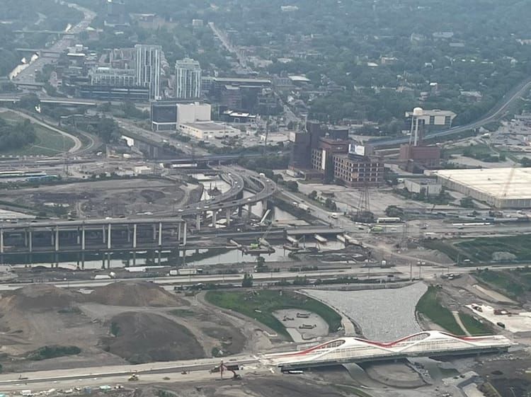
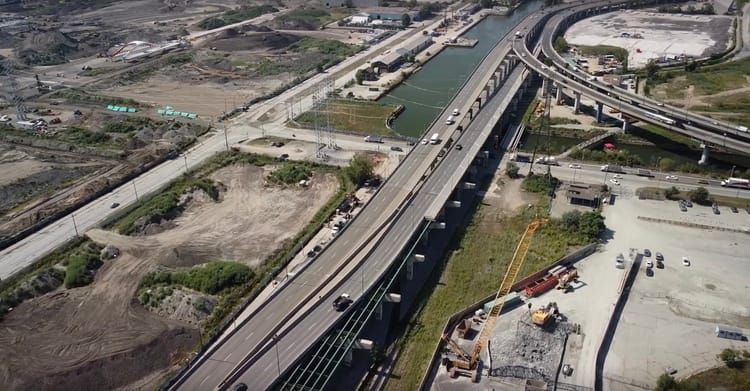
This photo was taken of the East-Toronto Waterfront by author Stefan Novakovic in June 2023
The photo was taken of from a plane, just before Billy Bishop Airport.
To start, this photo is taken of the mouth of the
Don Valley River
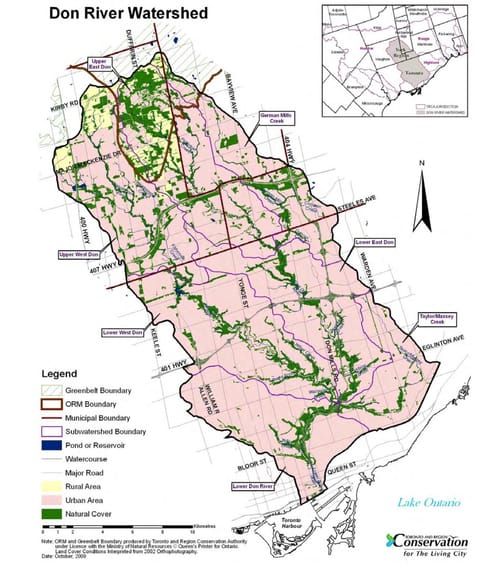
- one of 2 major rivers systems in Toronto. A huge system of rivers - from golf-courses in
Richmond Hill
- flow into, and then down this river. 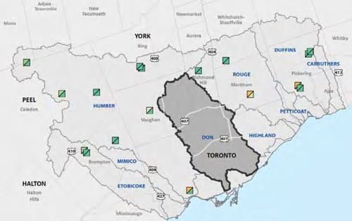
In the mid-1800s, Toronto suffered severe cholera epidemics. (1832, 1834, and 1854).
At the time, diseases such as cholera, and typhoid were believed to be caused by stagnant water.
For this reason, a channel was dug by hand in 1880, and the river was straightened.
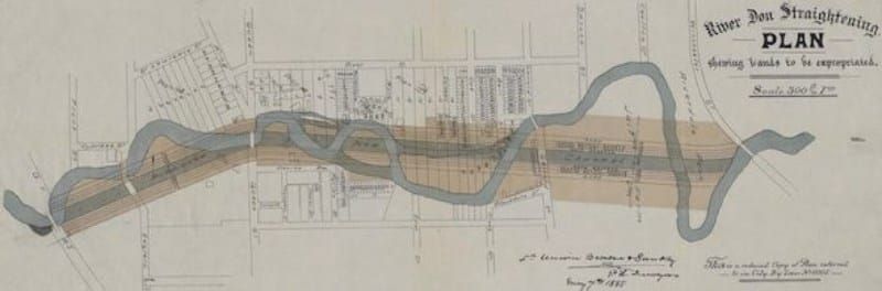
You can see how it looks today, in this beautiful graphic by DTAH
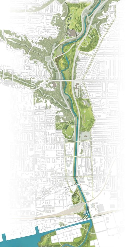
You can see that until recently, the river ran into a hard-right turn, at the bottom,
causing catastrophic flooding, almost every year:
causing catastrophic flooding, almost every year:
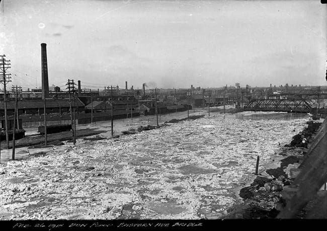
in 1918
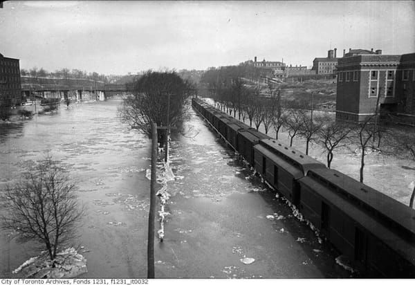
in 1920
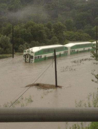
in 2023
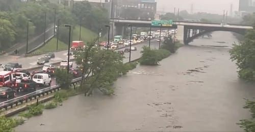
in 2024
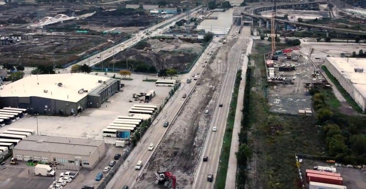
ya - so you can see the attempt to naturalize the Don River, flowing all the way from the horizon -
right into the center point of this photo
the water is just doing what it's told,
and its being told to lay waste to a choke point in our transportation network.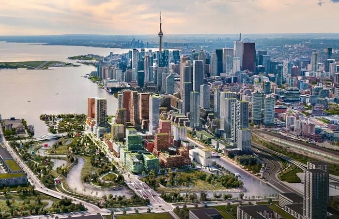
and its being told to lay waste to a choke point in our transportation network.
once the project is complete, it will house 15 thousand people
Ok, but what is going on with this highway?
it looks expensive. does it really just end?
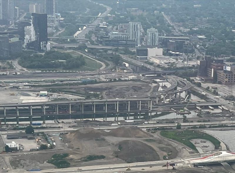
yes it does.
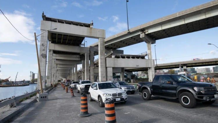
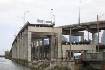
yep.
it was demolished in 2001, and has not been replaced.
before
after
25 years later, it is still just hanging there.
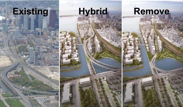
At the time, this plan was described as the "hybrid" solution,
and it sounded like the smart thing to do, in what was a bitter and convoluted municipal debate.
and it sounded like the smart thing to do, in what was a bitter and convoluted municipal debate.
what happens if you want to drive from the left side → to the right?
or the right side ← to the left?